


SMITHFIELD — The National Weather Service says rain moving into Johnston County late Wednesday could briefly change to light snow or a wintry mix by Wednesday night, though significant impacts are not expected.
Light rain is expected to develop across central North Carolina late Wednesday, with temperatures remaining above freezing through much of the day. Periods of rain will continue into Wednesday evening, with total rainfall amounts generally ranging from a quarter to half an inch west of U.S. 1 and up to 1 inch east of the highway.
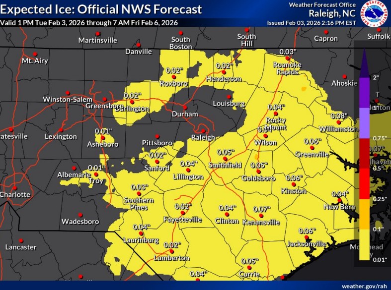
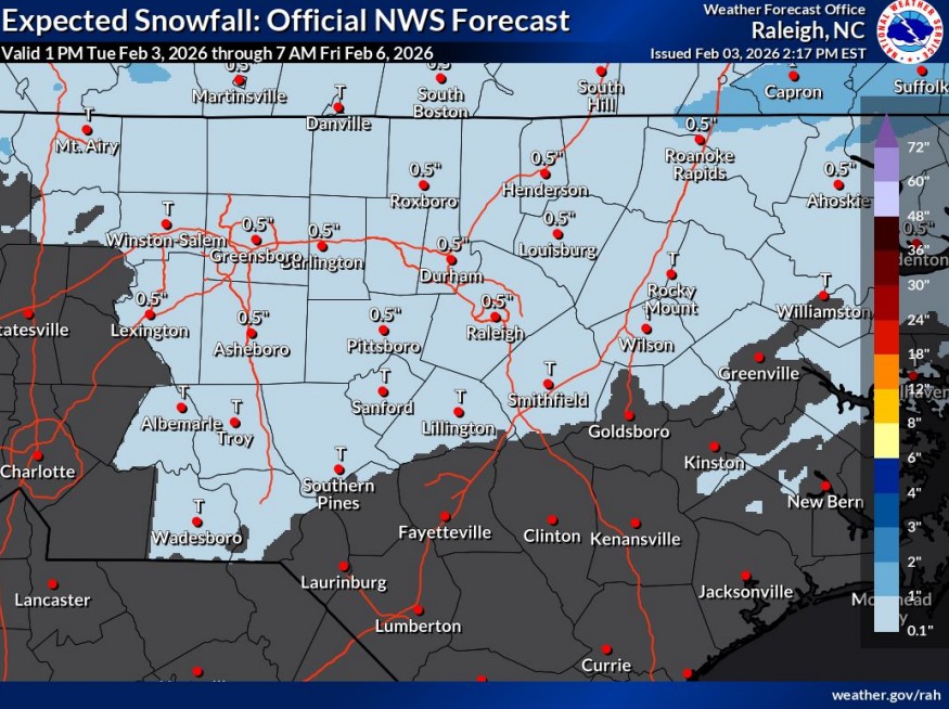
As colder air moves in Wednesday night, rain is expected to transition to a mix of freezing rain, sleet and snow between roughly 7 p.m. and 10 p.m. Any snow accumulation in Johnston County is expected to be light — less than half an inch — with ice accretion generally under one-tenth of an inch.
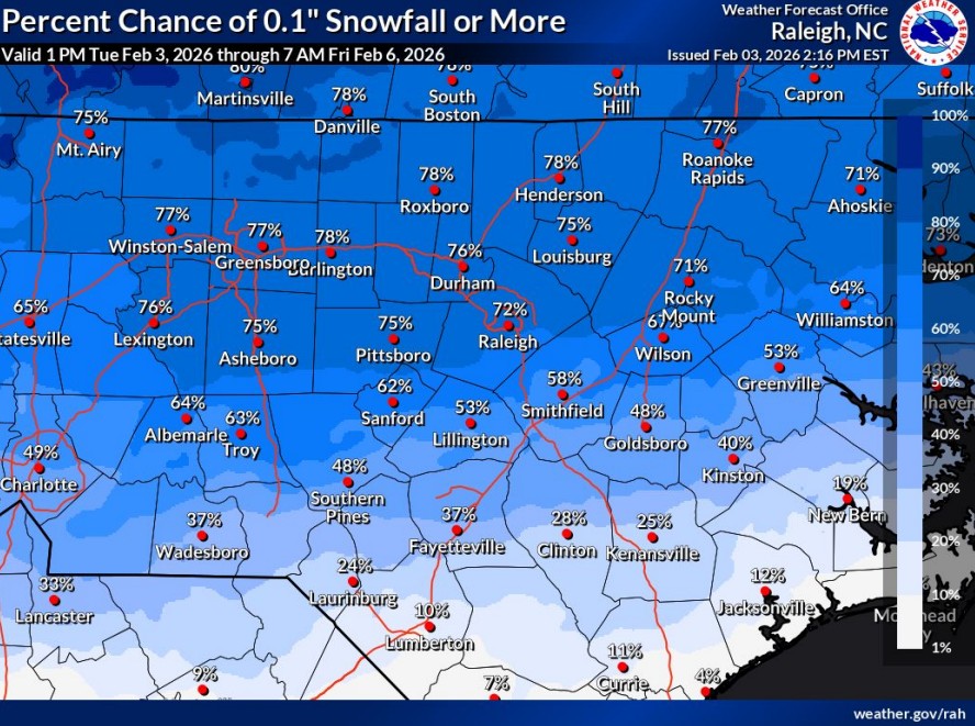
Forecasters say the best chance for accumulating snow will remain north of Interstate 85 and closer to the Virginia border. Areas south of U.S. 64, including much of Johnston County, are expected to see little to no accumulation.
Even so, brief periods of slick travel could develop late Wednesday night into early Thursday morning, especially on bridges and untreated roads. Rainfall combined with melting snow from earlier systems could also lead to minor poor drainage issues in some areas.
Precipitation is expected to exit central North Carolina around daybreak Thursday, with improving conditions later in the morning.
Officials urge drivers to remain cautious during the overnight hours and early Thursday, particularly in areas where precipitation may linger as temperatures hover near freezing.
Subscribe to get the latest posts sent to your email.