


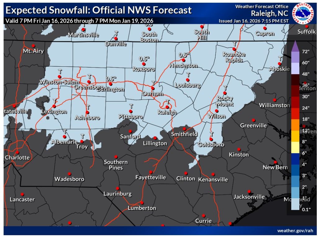
Some Johnston County residents may see a brief wintery mix this weekend as light rain developing late Saturday night could mix with and change to wet snow at times on Sunday, according to the National Weather Service (NWS).
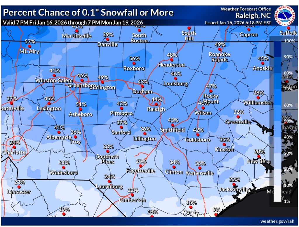
Temperatures are expected to be just cold enough for a trace of snow accumulation, mainly on grassy and elevated surfaces. The NWS notes the chance for any accumulating snow appears to be over the northeast Piedmont, from Raleigh north and northeast.
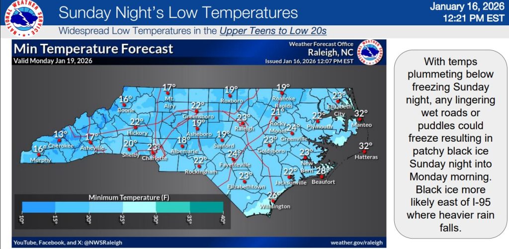
Officials warn that any lingering wet roads or puddles could freeze as temperatures plunge below freezing Sunday night, creating the potential for patchy black ice into Monday morning. The NWS advises that areas east of I-95, where heavier rain falls, are particularly at risk.
Hazard Impacts:
Residents are urged to monitor conditions closely this weekend and exercise caution if traveling Sunday evening or Monday morning.
Subscribe to get the latest posts sent to your email.