


SMITHFIELD, N.C. — Residents across central North Carolina, including Johnston County, should prepare for the possibility of severe weather Monday as forecasters warn of a heightened risk for damaging storms.
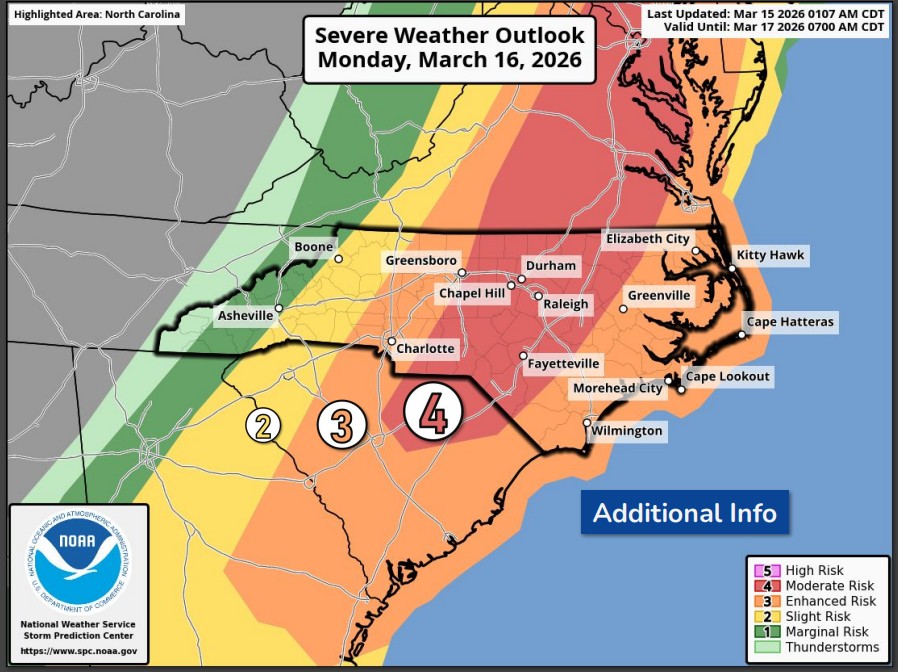
The National Weather Service has upgraded the area to a “moderate risk” for severe weather on Monday, March 16. That level means storms could be more widespread than usual and may include a few significant severe events.
The greatest risk is expected between 10 a.m. and 7 p.m., when a line of strong storms is forecast to move across the region.
Forecasters say the storms could bring damaging wind gusts over 70 mph, large hail, and the possibility of tornadoes. Some tornadoes could be strong, and isolated storms that form ahead of the main line could become especially dangerous.
Central North Carolina—including communities such as Raleigh, Durham, Fayetteville, and Smithfield—is in the area with the highest concern.
The storms may begin as individual thunderstorms capable of producing tornadoes and large hail before merging into a larger line of storms capable of producing widespread damaging winds.
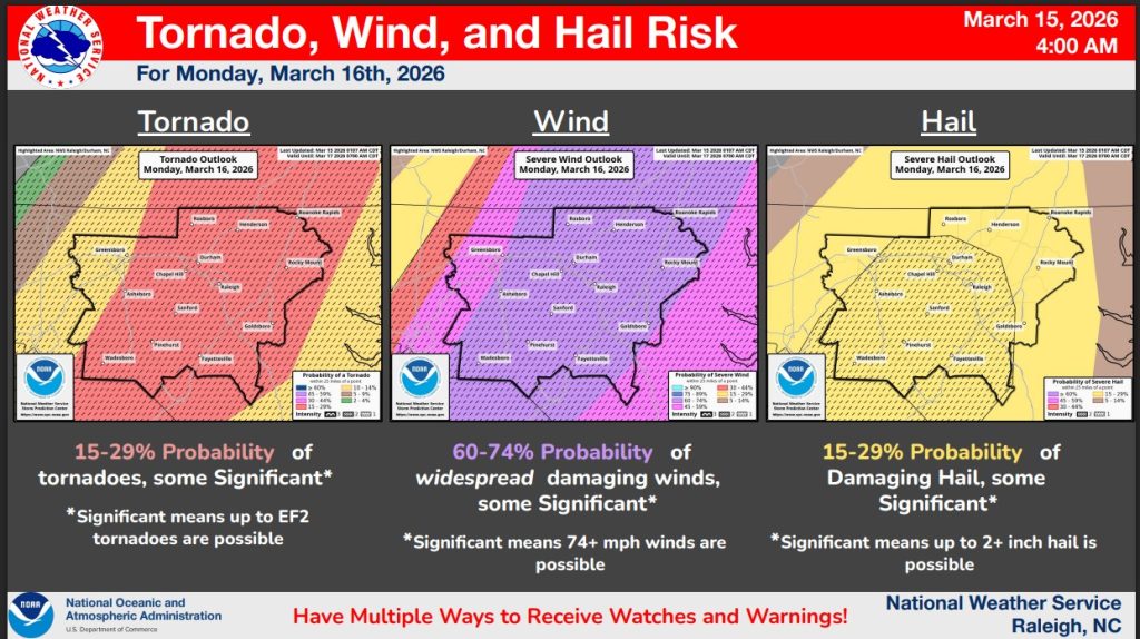
Forecasters say there is roughly a 15–30% chance of tornadoes, a 60–70% chance of damaging wind gusts, and a 15–30% chance of large hail somewhere within the risk area.
Officials are urging residents to review their severe weather safety plans and make sure they have multiple ways to receive weather alerts, such as weather radios, smartphone alerts, or local media.
The Weather Service advises people to identify a safe place in their home—such as an interior room on the lowest floor—where they can quickly take shelter if a tornado warning is issued.
Subscribe to get the latest posts sent to your email.