


JOHNSTON COUNTY — Johnston County is under a Winter Storm Warning from 10:00 P.M. Friday through 1:00 P.M. Sunday, with forecasters calling for heavy snow, strong winds and a prolonged period of dangerous cold that could affect travel, utilities and daily life across the county.
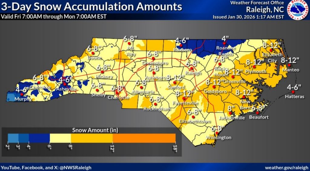
The National Weather Service in Raleigh said snowfall totals of 4 to 8 inches are expected across much of central North Carolina, including Johnston County. Localized areas could see significantly higher totals if narrow bands of heavier snow develop, while other areas may receive less snow than forecast. Forecasters stressed that exact placement of heavier snow bands remains uncertain and could shift with later updates.
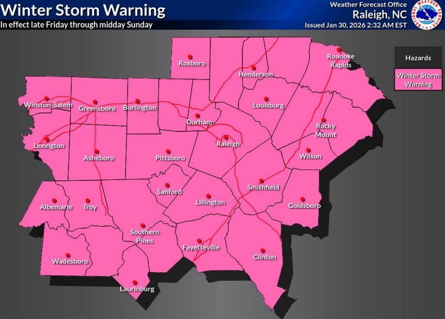
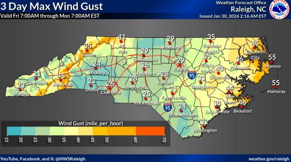
Snow is expected to begin Friday evening, intensify overnight and continue into Saturday, with lingering impacts into Sunday. Winds gusting between 25 and 35 mph — with occasional higher gusts possible — may lead to blowing and drifting snow and reduced visibility, particularly Saturday and Sunday. These conditions could make travel difficult or even impossible at times.
Road conditions are expected to deteriorate quickly once snow begins, especially on bridges and overpasses, which tend to ice over first. Officials warned that emergency travel could be slowed during the height of the storm.
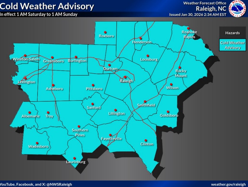
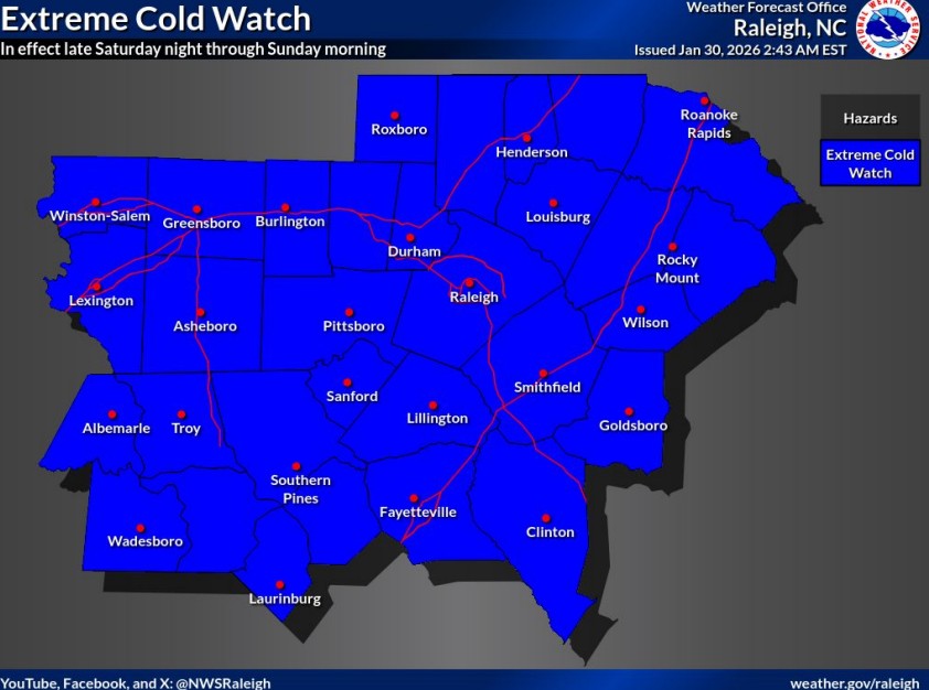
Cold will accompany the storm before and after snowfall. A Cold Weather Advisory is in effect from 1 a.m. Saturday until 1 a.m. Sunday, with wind chills expected to range from near zero to 9 degrees. That advisory is followed by an Extreme Cold Watch from late Saturday night through Sunday morning, when wind chills as low as 5 below zero are possible.
Forecasters said wind chills may remain in the single digits to teens from Friday night through Monday, making prolonged outdoor exposure dangerous. Frostbite and hypothermia can occur quickly on exposed skin, particularly during the overnight hours Saturday into Sunday.
The combination of heavy snow, gusty winds and extreme cold raises the risk of scattered power outages, mainly from falling trees and limbs weighed down by snow. While widespread outages are not currently expected, officials said even brief outages could become dangerous given the cold.
Prolonged freezing temperatures could also lead to ruptured water pipes, especially in homes without adequate insulation. After the storm exits, black ice is expected to be a concern on untreated roads Sunday night and into early next week as temperatures remain below freezing.
Residents are urged to avoid unnecessary travel, dress in warm layers when outdoors and keep pets indoors as much as possible. Officials also recommend checking frequently on older adults, neighbors and others who may be vulnerable to the cold. Portable heaters should be used safely, and generators or grills should never be used indoors.
Forecasters said that snow totals, wind impacts and timing could change as the storm evolves. Residents are encouraged to follow updates through the weekend.
Subscribe to get the latest posts sent to your email.