
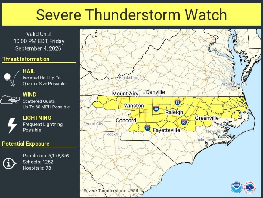
SMITHFIELD, N.C. – Johnston County is under a Severe Thunderstorm Watch until 10 p.m. Friday, Sept. 4, as storms capable of producing damaging winds, hail and frequent lightning move across portions of North Carolina.
The National Weather Service Storm Prediction Center issued the Severe Thunderstorm Watch for Johnston County and 47 other North Carolina counties.
The National Weather Service in Raleigh said scattered thunderstorms will be capable of producing damaging wind gusts and hail through the afternoon and evening.
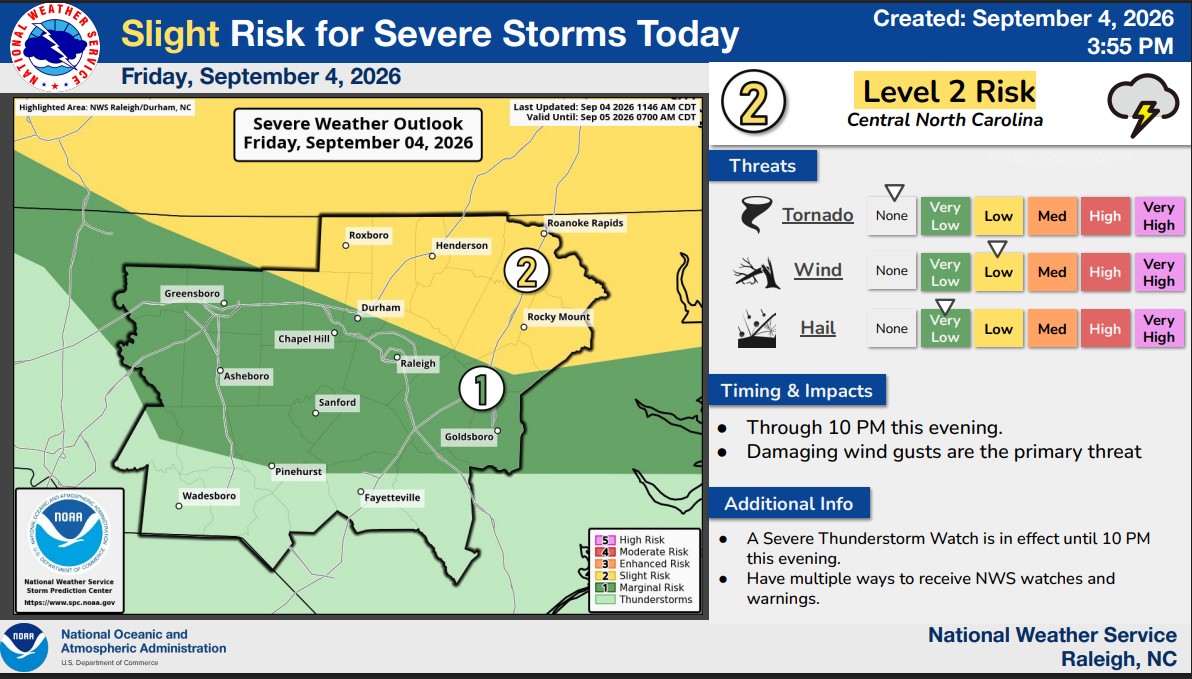
A Severe Thunderstorm Watch means conditions are favorable for severe storms to develop. Residents should be prepared to take shelter if a Severe Thunderstorm Warning is issued for their location.
The watch covers a broad section of the state, stretching from the mountains through the Piedmont and into eastern North Carolina.
Counties included are Alamance, Alleghany, Ashe, Bertie, Camden, Caswell, Chatham, Chowan, Currituck, Davidson, Durham, Edgecombe, Forsyth, Franklin, Gates, Granville, Greene, Guilford, Halifax, Harnett, Hertford, Johnston, Lee, Martin, Montgomery, Moore, Nash, Northampton, Orange, Pasquotank, Perquimans, Person, Pitt, Randolph, Rockingham, Stanly, Stokes, Surry, Tyrrell, Vance, Wake, Warren, Washington, Watauga, Wayne, Wilkes, Wilson and Yadkin.
Johnston County was already under a Heat Advisory Friday, with the National Weather Service warning of dangerously hot and humid conditions. The advisory remains in effect until 8 p.m. and includes Smithfield, Clayton and Selma.
Subscribe to get the latest posts sent to your email.